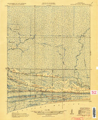
1935 Map of Johnsons Bayou
USGS Topo · Published 1935About this map
Peveto Ridge and Smith Ridge form the habitable backbone of this Cameron Parish landscape, where coastal cheniers rise above the expansive marshlands. The 1934 survey, compiled in part from early Army Air Corps aerial photography, captures a settlement pattern strictly dictated by these elevated sandy ridges. Along the southern edge near the Gulf of Mexico, the community infrastructure of Johnsons Bayou is clearly marked, including the Johnsons Bayou Sch and the Johnsons Bayou Post Office.
Find a feature on this map
19 named features on this map. Tap any name to fly to it.
Don’t see what you’re looking for? This feature index may not catch every label — zoom into the map to look around manually.
Map Details
Editions of this 1935 Johnsons Bayou Map
2 editions found
Other maps of this area

1932 · Sabine Pass NE
USGS Topo · 1:31,680

1932 · Port Arthur NE
USGS Topo · 1:31,680

1934 · Johnsons Bayou
USGS Topo · 1:24,000

1934 · Peveto Beach
USGS Topo · 1:24,000

1934 · Greens Bayou
USGS Topo · 1:24,000

1934 · Five Lakes
USGS Topo · 1:24,000

1935 · Peveto Beach
USGS Topo · 1:31,680

1935 · Five Lakes
USGS Topo · 1:31,680

1935 · Greens Bayou
USGS Topo · 1:31,680

1935 · Johnsons Bayou
USGS Topo · 1:31,680