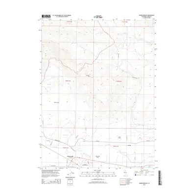
2015 Map of Johnstonville
USGS Topo · Published 2015About this map
Honey Lake Valley is the dominant topographic feature of this Northern California landscape, where the Susan River flows eastward toward the Great Basin. The settlement of Johnstonville serves as a local hub, situated near the Johnstonville Cemetery and the Susanville Municipal Airport. The map documents a complex water management system essential for high-desert life, including the Lake Leavitt Inlet Canal, Main Canal, and Jensen Slu, which direct water toward Lake Leavitt. To the north, the terrain rises sharply toward Antelope Mtn, overlooking Hidden Valley and Rices Canyon. This 2015 survey provides a clear look at the rural road network, from major routes like Johnstonville Rd to smaller thoroughfares like Lady Bug Ln and Bangham Ln, reflecting the modern agricultural and residential footprint of the region.
Find a feature on this map
38 named features on this map. Tap any name to fly to it.
Don’t see what you’re looking for? This feature index may not catch every label — zoom into the map to look around manually.
Map Details
Editions of this 2015 Johnstonville Map
This is the sole edition of this map. No revisions or reprints were ever made.
Other maps of this area

1886 · Honey Lake
USGS Topo · 1:250,000

1891 · Honey Lake
USGS Topo · 1:250,000

1893 · Honey Lake
USGS Topo · 1:250,000

1954 · Susanville
USGS Topo · 1:62,500

1954 · Litchfield
USGS Topo · 1:62,500

1954 · Karlo
USGS Topo · 1:62,500

1954 · Fredonyer Peak
USGS Topo · 1:62,500

1955 · Westwood
USGS Topo · 1:250,000

1958 · Westwood
USGS Topo · 1:250,000

1959 · Westwood
USGS Topo · 1:250,000