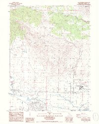
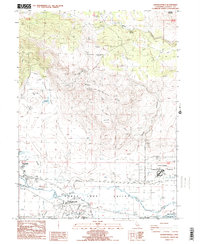
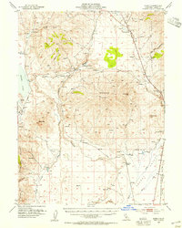
1988 Map of Johnstonville
USGS Topo · Published 1989About this map
The Honey Lake Valley landscape in the late 1980s is defined by a complex network of water management and institutional infrastructure. The Susan River flows eastward, joined by Jensen Slough and Lassen Creek, feeding into an irrigation system that includes the Main Canal and the Lake Leavitt Spillway 4096. The settlement of Johnstonville serves as a local hub near the Susanville Municipal Airport, while the large complex of the California Correctional Center dominates the eastern flatlands.
Find a feature on this map
27 named features on this map. Tap any name to fly to it.
Don’t see what you’re looking for? This feature index may not catch every label — zoom into the map to look around manually.
Map Details
Editions of this 1988 Johnstonville Map
2 editions found
Other maps of this area

1886 · Honey Lake
USGS Topo · 1:250,000

1891 · Honey Lake
USGS Topo · 1:250,000

1893 · Honey Lake
USGS Topo · 1:250,000
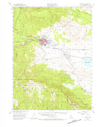
1954 · Susanville
USGS Topo · 1:62,500
1954 · Litchfield
USGS Topo · 1:62,500
1954 · Karlo
USGS Topo · 1:62,500
1954 · Fredonyer Peak
USGS Topo · 1:62,500

1955 · Westwood
USGS Topo · 1:250,000

1958 · Westwood
USGS Topo · 1:250,000

1959 · Westwood
USGS Topo · 1:250,000