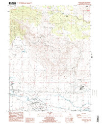
1988 Map of Johnstonville
USGS Topo · Published 1989About this map
Johnstonville sits at the base of the prominent Antelope Mtn within the broader Honey Lake Valley during the late 1980s. This survey detail illustrates a transition between the rugged elevations of Tunnison Mountain and the complex drainage network of the basin floor, where the Susan River is joined by the Jensen Slough and Brockman Slough. The infrastructure of Lassen County is well-defined here, showing the Susanville Municipal Airport and the sprawling California Correctional Center complex. Water management is a primary feature of the landscape, evidenced by the Main Canal, numerous guzzlers, and a network of levees. Local genealogists may find interest in the documented Cem and Trailer Park near the river, while the presence of a Rifle Range and Pistol Range in Rices Canyon speaks to the area's specialized land use at the time.
Find a feature on this map
38 named features on this map. Tap any name to fly to it.
Don’t see what you’re looking for? This feature index may not catch every label — zoom into the map to look around manually.
Map Details
Editions of this 1988 Johnstonville Map
2 editions found
Other maps of this area

1886 · Honey Lake
USGS Topo · 1:250,000

1891 · Honey Lake
USGS Topo · 1:250,000

1893 · Honey Lake
USGS Topo · 1:250,000

1954 · Susanville
USGS Topo · 1:62,500

1954 · Litchfield
USGS Topo · 1:62,500

1954 · Karlo
USGS Topo · 1:62,500

1954 · Fredonyer Peak
USGS Topo · 1:62,500

1955 · Westwood
USGS Topo · 1:250,000

1958 · Westwood
USGS Topo · 1:250,000

1959 · Westwood
USGS Topo · 1:250,000