2022 Map of Johnstown
USGS Topo · Published 2022About this map
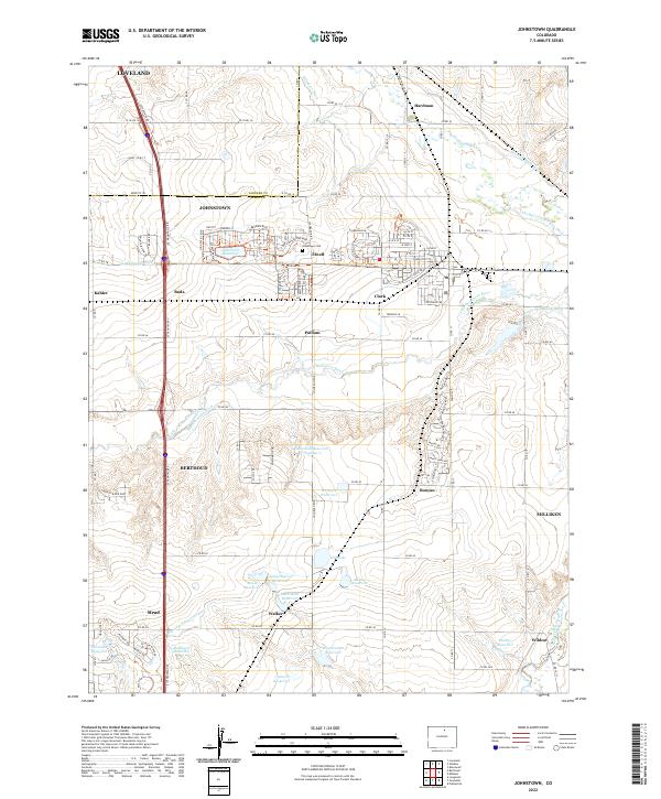
Johnstown serves as a central hub in this agricultural region of Northern Colorado, where the landscape is intricately defined by a dense network of water management features. The movement of water across these plains is managed by historical engineering works like the Hillsboro Ditch, Home Supply Ditch, and Farmers Extension Canal, which divert the flows of the Big Thompson River and Little Thompson River to sustain local farming. Surrounding the town are several smaller named settlements including Elwell, Hardman, and Buda, reflecting the steady expansion of rural communities along the Larimer and Weld county line. This map details the transition from traditional irrigation infrastructure to modern residential developments, including many named reservoirs such as Marshall Reservoir Number 2 and the Johnstown Reservoir. Researchers can also locate the Johnstown Cem and outlying rural junctions like Pulliam and Walker.
Find a feature on this map
120 named features on this map. Tap any name to fly to it.
Don’t see what you’re looking for? This feature index may not catch every label — zoom into the map to look around manually.
Map Details
Editions of this 2022 Johnstown Map
This is the sole edition of this map. No revisions or reprints were ever made.