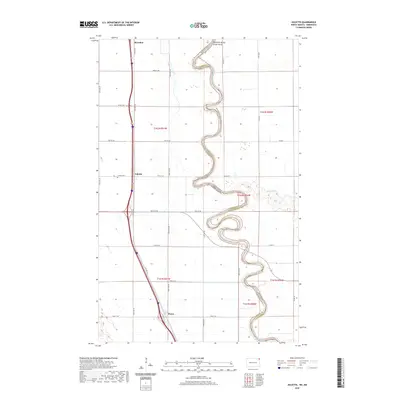
2020 Map of Joliette
USGS Topo · Published 2020About this map
Joliette stands at the heart of this Red River Valley landscape, where the modern transport corridor of Interstate 29 parallels the historic path of Old Hwy 81. The map documents a highly structured agricultural grid in Pembina County, interrupted only by the tight, serpentine meanders of the Red River of the North. This waterway serves as the natural boundary between North Dakota and Minnesota, its complex oxbows and flood-prone banks contrasting sharply with the surveyed precision of the surrounding townships. Small collection points and sidings like McArthur to the north and Fleece to the south mark the rural landscape, while the Joliette Cem provides a specific point of interest for those tracing family roots in this border region. The confluence near Two Rivers further illustrates the hydrological complexity of this fertile valley floor.
Find a feature on this map
36 named features on this map. Tap any name to fly to it.
Don’t see what you’re looking for? This feature index may not catch every label — zoom into the map to look around manually.
Map Details
Editions of this 2020 Joliette Map
This is the sole edition of this map. No revisions or reprints were ever made.
Other maps of this area

1939 · Drayton
USGS Topo · 1:62,500

1939 · Glasston
USGS Topo · 1:62,500

1939 · Pembina
USGS Topo · 1:62,500

1941 · Drayton
USGS Topo · 1:62,500

1941 · Glasston
USGS Topo · 1:62,500

1941 · Bathgate
USGS Topo · 1:62,500

1941 · Pembina
USGS Topo · 1:62,500

1952 · Thief River Falls
USGS Topo · 1:250,000

1956 · Thief River Falls
USGS Topo · 1:250,000

1957 · Thief River Falls
USGS Topo · 1:250,000