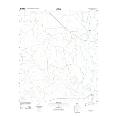
2012 Map of Jonathan
USGS Topo · Published 2012About this map
The winding courses of Kittrell Mill Cr and Big Cr define the rural landscape of Greene County in this 2012 survey. Small, established communities like Bradley and Hillman are situated along a network of local roads including Old Hwy 24 and Unity Rd. Local history is anchored by sites such as the Bradley Cem and Hillman Cem, while the Green Lookout Tower stands as a distinct landmark in the central portion of the quadrangle. The map reveals a land heavily influenced by its drainage patterns, with numerous tributaries such as Indian Cr, Brushy Cr, and Little Cr flowing through the area. This modern survey provides a clear view of the settlement patterns and geographic features that have shaped the region, from the northern reaches near Byrd to the southern outskirts near Hillman.
Find a feature on this map
50 named features on this map. Tap any name to fly to it.
Don’t see what you’re looking for? This feature index may not catch every label — zoom into the map to look around manually.
Map Details
Editions of this 2012 Jonathan Map
This is the sole edition of this map. No revisions or reprints were ever made.
Other maps of this area

1947 · Beaumont
USGS Topo · 1:62,500

1949 · Beaumont
USGS Topo · 1:62,500

1953 · Hattiesburg
USGS Topo · 1:250,000

1958 · Hattiesburg
USGS Topo · 1:250,000

1963 · Brewer
USGS Topo · 1:24,000

1964 · Clark
USGS Topo · 1:24,000

1964 · Avera
USGS Topo · 1:24,000

1972 · Leakesville
USGS Topo · 1:24,000
1972 · Vernal
USGS Topo · 1:24,000

1973 · Jonathan
USGS Topo · 1:24,000