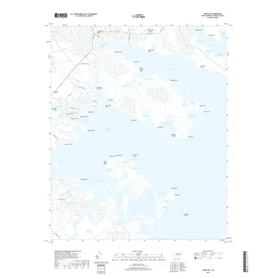
2019 Map of Jones Bay
USGS Topo · Published 2019About this map
The low-lying coastal marshes of Pamlico County define this reach of Jones Bay, where the Intracoastal Waterway cuts through a landscape of tidal creeks and brackish points. The settlement of Mesic sits on the western edge of the quadrangle, connected to the interior by local routes like Meekins Rd and Gale Creek Rd. This area is characterized by an intricate network of water bodies, including Gum Swamp and Doll Creek, which separate larger landmasses like Goose Creek Island.
Find a feature on this map
84 named features on this map. Tap any name to fly to it.
Don’t see what you’re looking for? This feature index may not catch every label — zoom into the map to look around manually.
Map Details
Editions of this 2019 Jones Bay Map
This is the sole edition of this map. No revisions or reprints were ever made.
Other maps of this area

1948 · Oriental
USGS Topo · 1:24,000

1949 · Point Of Marsh
USGS Topo · 1:24,000

1950 · Point Of Marsh
USGS Topo · 1:24,000

1950 · Vandemere
USGS Topo · 1:24,000

1950 · Lowland
USGS Topo · 1:24,000

1950 · South Creek
USGS Topo · 1:24,000

1950 · Jones Bay
USGS Topo · 1:24,000

1951 · Brant Island
USGS Topo · 1:24,000

1951 · Broad Creek
USGS Topo · 1:24,000

1951 · Pamlico Point
USGS Topo · 1:24,000