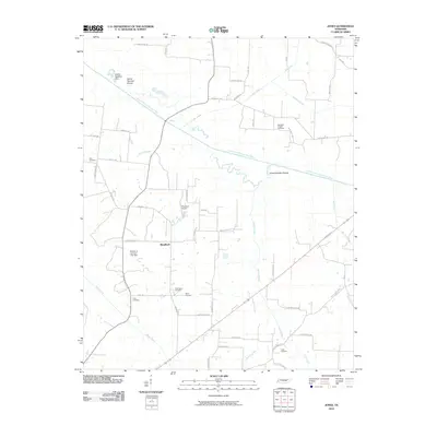
2010 Map of Jones
USGS Topo · Published 2010About this map
South Fork Forked Deer River dominates the northern landscape of this Haywood County region, carving a winding path past numerically designated river features like Island Number Ten and Island Number Twelve. The settlement at Bradford serves as a central point in a network of family-named roads and country cemeteries that speak to the area's deep-rooted genealogy. Small tributaries, including Jacocks Creek and Whitson Creek, drain the agricultural lands between the river and the southern hills. Local landmarks like Thornton Airport and the William A Jameson Lake Dam reflect the 21st-century infrastructure of this rural Tennessee pocket. This map is particularly useful for those tracing family ties to sites like Zion Cemetery, Wortham Chapel Cemetery, or Hess Cemetery, which are preserved alongside the modern road grid.
Find a feature on this map
54 named features on this map. Tap any name to fly to it.
Don’t see what you’re looking for? This feature index may not catch every label — zoom into the map to look around manually.
Map Details
Editions of this 2010 Jones Map
This is the sole edition of this map. No revisions or reprints were ever made.
Other maps of this area

1939 · Halls
USGS Topo · 1:62,500

1950 · Sunnyhill
USGS Topo · 1:24,000

1950 · Brownsville
USGS Topo · 1:24,000

1951 · Brownsville
USGS Topo · 1:24,000

1951 · Sunnyhill
USGS Topo · 1:24,000

1952 · Chestnut Bluff
USGS Topo · 1:24,000

1956 · Blytheville
USGS Topo · 1:250,000

1959 · Blytheville
USGS Topo · 1:250,000

1959 · Bells
USGS Topo · 1:24,000

1959 · Denmark
USGS Topo · 1:24,000