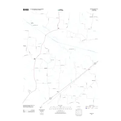
2013 Map of Jones
USGS Topo · Published 2013About this map
The South Fork Forked Deer River winds through this West Tennessee landscape, defining a region characterized by its small agricultural communities and complex water systems. Notable landmarks like Island Number Twelve, Island Number Ten, and Island Number Eleven sit within the river's path, reflecting the shifting nature of the local hydrology. Small settlements such as Jones, Allens, and Owl City are connected by a network of rural roads that often bear the names of local families, such as Hess Rd and Taylor Rd. Genealogists may find value in the presence of Wortham Cemetery Rd and Taylor Cemetery Rd, which point to established family heritage sites in the area. The inclusion of Thornton Airport near Bradford highlights the intersection of traditional river-bottom farming with modern local infrastructure in Haywood County.
Find a feature on this map
68 named features on this map. Tap any name to fly to it.
Don’t see what you’re looking for? This feature index may not catch every label — zoom into the map to look around manually.
Map Details
Editions of this 2013 Jones Map
This is the sole edition of this map. No revisions or reprints were ever made.
Other maps of this area

1939 · Halls
USGS Topo · 1:62,500

1950 · Sunnyhill
USGS Topo · 1:24,000

1950 · Brownsville
USGS Topo · 1:24,000

1951 · Brownsville
USGS Topo · 1:24,000

1951 · Sunnyhill
USGS Topo · 1:24,000

1952 · Chestnut Bluff
USGS Topo · 1:24,000

1956 · Blytheville
USGS Topo · 1:250,000

1959 · Blytheville
USGS Topo · 1:250,000

1959 · Bells
USGS Topo · 1:24,000

1959 · Denmark
USGS Topo · 1:24,000