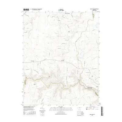
2016 Map of Jones Knob
USGS Topo · Published 2016About this map
Banner Springs and Roslin anchor the northern reaches of this landscape, situated at the edge of the Cumberland Plateau in Tennessee. The area is defined by its network of headwaters and springs, notably Boiling Spring and the S Prong Clear Fork, which carve through the plateau. Small family settlements and dispersed cemeteries like Westfelt Cem and Smith Cem reflect a rural pattern of life that persists into the 21st century. To the south, the terrain becomes more dramatic as it drops toward the Obed Wild and Scenic River corridor, where the Clear Creek drainage creates deep relief such as Big Hollow. This modern survey documents the legacy of early homesteads through road names like Leamon Hall Rd and Virgil Beaty Rd, while showing how the landscape is managed through the Land of Lakes Catfish Farm Lake.
Find a feature on this map
89 named features on this map. Tap any name to fly to it.
Don’t see what you’re looking for? This feature index may not catch every label — zoom into the map to look around manually.
Map Details
Editions of this 2016 Jones Knob Map
This is the sole edition of this map. No revisions or reprints were ever made.
Other maps of this area

1895 · Wartburg
USGS Topo · 1:125,000

1896 · Wartburg
USGS Topo · 1:125,000

1897 · Standingstone
USGS Topo · 1:125,000

1898 · Standingstone
USGS Topo · 1:125,000

1935 · Isoline
USGS Topo · 1:24,000

1935 · Clarkrange
USGS Topo · 1:24,000

1936 · Hebbertsburg
USGS Topo · 1:24,000

1936 · Fox Creek
USGS Topo · 1:24,000

1936 · Twin Bridges
USGS Topo · 1:24,000

1936 · Jones Knob
USGS Topo · 1:24,000