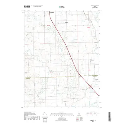
2019 Map of Jonesville
USGS Topo · Published 2019About this map
Waynesville and Jonesville anchor a landscape defined by the intersection of southern Indiana's agrarian roots and the modern transit corridor of Interstate 65. The terrain shifts from the managed fields of Bartholomew Co into Jackson Co, following the meandering path of the East Fork White River and its associated wetlands. The presence of smaller residential pockets like Little Acre and Bobtown suggests the persistence of community nodes outside the larger influence of nearby Columbus. The hydrology of the area is particularly distinct, featuring numerous named water bodies such as Lake Barbara, Thompsons Lake, and Peters Lake, alongside the significant natural drainage of Thompson Slough. These features, combined with the rise of Wrights Hill, provide a detailed look at how local elevation and water systems have influenced the placement of rural roads and homesteads.
Find a feature on this map
85 named features on this map. Tap any name to fly to it.
Don’t see what you’re looking for? This feature index may not catch every label — zoom into the map to look around manually.
Map Details
Editions of this 2019 Jonesville Map
This is the sole edition of this map. No revisions or reprints were ever made.
Other maps of this area

1942 · Franklin
USGS Topo · 1:125,000

1942 · Columbus
USGS Topo · 1:125,000

1948 · New Bellsville
USGS Topo · 1:24,000

1948 · Waymansville
USGS Topo · 1:24,000

1953 · Cincinnati
USGS Topo · 1:250,000

1953 · Indianapolis
USGS Topo · 1:250,000

1956 · Indianapolis
USGS Topo · 1:250,000

1956 · Vincennes
USGS Topo · 1:250,000

1956 · Louisville
USGS Topo · 1:250,000

1957 · Indianapolis
USGS Topo · 1:250,000