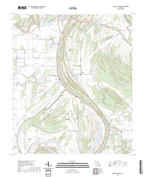
2024 Map of Jonesville South
USGS Topo · Published 2024About this map
The confluence of the Little River and Black River anchors this study of the Louisiana riverlands, where the modern settlement of Jonesville sits at the northern edge of the survey. The landscape is defined by its complex hydrology, featuring a dense network of swampy backwaters and lakes such as Carr Lake, Willow Lake, and the extensive Gin Slough. These waterways are flanked by numerous historic burial grounds that speak to the long-standing agricultural communities of the region, including the Security Plantation Cem and Moss Grove Plantation Cem.
Find a feature on this map
86 named features on this map. Tap any name to fly to it.
Don’t see what you’re looking for? This feature index may not catch every label — zoom into the map to look around manually.
Map Details
Editions of this 2024 Jonesville South Map
This is the sole edition of this map. No revisions or reprints were ever made.
Other maps of this area

1935 · Tooleys
USGS Topo · 1:62,500

1939 · Red Gum
USGS Topo · 1:62,500

1939 · Deer Park
USGS Topo · 1:62,500

1941 · Manifest
USGS Topo · 1:62,500

1941 · Tooleys
USGS Topo · 1:62,500

1953 · Natchez
USGS Topo · 1:250,000

1956 · Natchez
USGS Topo · 1:250,000

1959 · Natchez
USGS Topo · 1:250,000

1960 · Jonesville
USGS Topo · 1:62,500
1960 · Eva
USGS Topo · 1:62,500