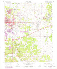
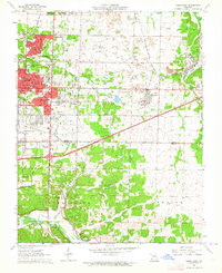
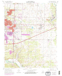
1963 Map of Joplin East
USGS Topo · Published 1979About this map
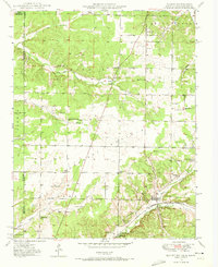
Joplin serves as the central anchor of this 1960s landscape, which transitioned into the late 1970s with significant suburban expansion shown in purple revision. The map reveals an area defined by heavy industry and community infrastructure, particularly evident in the numerous Quarries and extensive Old Railroad Grade networks that cross the terrain. Cultural landmarks like the Joe Becker Memorial Stadium and the Gateway Drive-in Theater highlight the mid-century social life of the region, while the southern portion remains more rural along Shoal Creek.
Find a feature on this map
52 named features on this map. Tap any name to fly to it.
Don’t see what you’re looking for? This feature index may not catch every label — zoom into the map to look around manually.
Map Details
Editions of this 1963 Joplin East Map
3 editions found
Other maps of this area

1886 · Joplin
USGS Topo · 1:125,000

1886 · Carthage
USGS Topo · 1:125,000

1894 · Joplin
USGS Topo · 1:125,000

1894 · Carthage
USGS Topo · 1:125,000

1907 · Wyandotte
USGS Topo · 1:125,000

1909 · Wyandotte
USGS Topo · 1:125,000
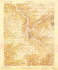
1916 · Neosho
USGS Topo · 1:62,500

1947 · Joplin
USGS Topo · 1:250,000

1949 · Joplin
USGS Topo · 1:250,000
1949 · Racine
USGS Topo · 1:24,000