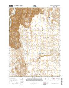
2014 Map of Jordan Craters North
USGS Topo · Published 2014About this map
Jordan Craters and the prominent Coffeepot Crater define this volcanic landscape in eastern Oregon. The terrain is characterized by intricate lava flows and distinct geological formations like Black Rocks and The Tongue. Water management is central to the land use shown here, with numerous small impoundments such as Claude Reservoir, Glover Reservoir, and Holdout Reservoir scattered across the high desert. The western edge of the map is marked by the steep descent toward the Owyhee River and its tributary, Birch Creek. A network of remote tracks, including Coffeepot Crater Rd and Morcom Rd, provides the only access through the rough lava beds and deep canyons like Blue Canyon. This survey captures the intersection of unique volcanic geology with the practical infrastructure required for ranching in a dry climate.
Find a feature on this map
26 named features on this map. Tap any name to fly to it.
Don’t see what you’re looking for? This feature index may not catch every label — zoom into the map to look around manually.
Map Details
Editions of this 2014 Jordan Craters North Map
This is the sole edition of this map. No revisions or reprints were ever made.
Other maps of this area

1955 · Boise
USGS Topo · 1:250,000

1958 · Boise
USGS Topo · 1:250,000

1962 · Boise
USGS Topo · 1:250,000

1967 · Diamond Butte
USGS Topo · 1:24,000

1967 · Rooster Comb
USGS Topo · 1:24,000

1969 · Jordan Craters South
USGS Topo · 1:24,000

1969 · Mc Cain Creek
USGS Topo · 1:24,000

1969 · Jordan Craters North
USGS Topo · 1:24,000

1969 · Cow Lakes
USGS Topo · 1:24,000

1972 · Big Mud Flat
USGS Topo · 1:24,000