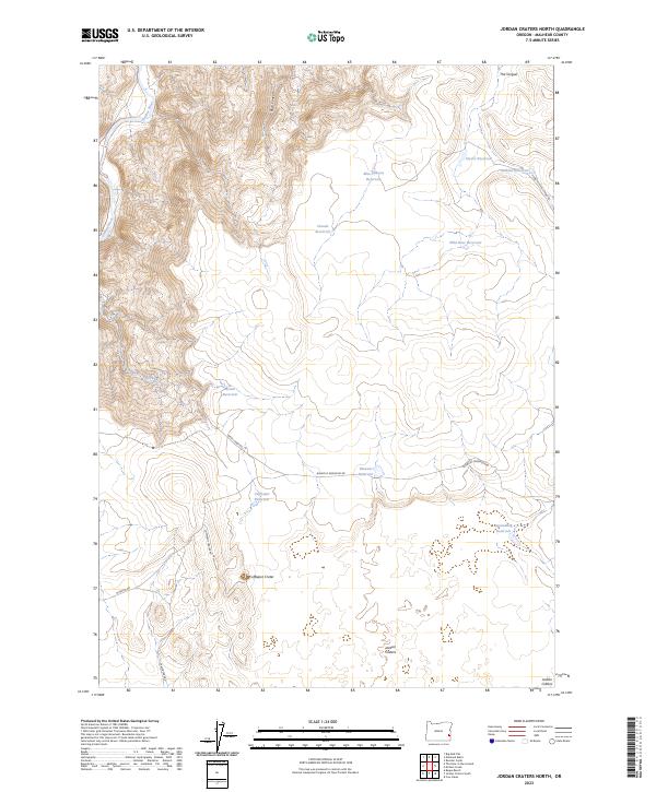
2023 Map of Jordan Craters North
USGS Topo · Published 2023About this map
Jordan Craters and the volcanic landscape of eastern Oregon dominate this topographic survey, where the Coffeepot Crater stands as a prominent geological landmark. The arid terrain is defined by a complex system of water management for ranching and livestock, evidenced by numerous named pools such as Glover Reservoir, Claude Reservoir, and Wild Rose Reservoir. In the northwestern corner, the Owyhee Wild and Scenic River carves through the land, flanked by distinctive formations like The Tongue. A network of unpaved tracks, including Birch Creek Rd and Coffepot Crater Rd, provides the only access through these expansive sections of Malheur County, illustrating the isolated nature of the high desert range before it reaches the canyon breaks.
Find a feature on this map
26 named features on this map. Tap any name to fly to it.
Don’t see what you’re looking for? This feature index may not catch every label — zoom into the map to look around manually.
Map Details
Editions of this 2023 Jordan Craters North Map
This is the sole edition of this map. No revisions or reprints were ever made.
Other maps of this area

1955 · Boise
USGS Topo · 1:250,000

1958 · Boise
USGS Topo · 1:250,000

1962 · Boise
USGS Topo · 1:250,000

1967 · Diamond Butte
USGS Topo · 1:24,000

1967 · Rooster Comb
USGS Topo · 1:24,000

1969 · Jordan Craters South
USGS Topo · 1:24,000

1969 · Mc Cain Creek
USGS Topo · 1:24,000

1969 · Jordan Craters North
USGS Topo · 1:24,000

1969 · Cow Lakes
USGS Topo · 1:24,000

1972 · Big Mud Flat
USGS Topo · 1:24,000