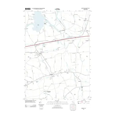
2013 Map of Jordan
USGS Topo · Published 2013About this map
The Old Erie Canal cuts a historic path through this central New York landscape, passing just north of Jordan, where the local grid meets the winding waters of Skaneateles Cr. This corridor has long served as a vital transportation artery, further evidenced by the rail lines connecting Skaneateles Junction and Memphis. To the north, the Seneca River meanders toward Jacks Reef, shaping a series of landforms including Jones Point and Big Island within Cross Lake.
Find a feature on this map
144 named features on this map. Tap any name to fly to it.
Don’t see what you’re looking for? This feature index may not catch every label — zoom into the map to look around manually.
Map Details
Editions of this 2013 Jordan Map
This is the sole edition of this map. No revisions or reprints were ever made.
Other maps of this area

1899 · Auburn
USGS Topo · 1:62,500

1899 · Skaneateles
USGS Topo · 1:62,500

1900 · Baldwinsville
USGS Topo · 1:62,500

1902 · Skaneateles
USGS Topo · 1:62,500

1902 · Weedsport
USGS Topo · 1:62,500

1902 · Auburn
USGS Topo · 1:62,500

1943 · Jordan
USGS Topo · 1:31,680

1943 · Lysander
USGS Topo · 1:31,680

1943 · Cato
USGS Topo · 1:31,680

1943 · Weedsport
USGS Topo · 1:31,680