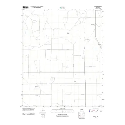
2010 Map of Jordan
USGS Topo · Published 2010About this map
Jordan and Lawson sit within a landscape of mesas and drainage basins in eastern New Mexico as documented in 2010. The terrain is defined by dramatic elevation changes, including Ragland Hill and the prominent Piñon Point overlooking the surrounding plains. The local infrastructure is characterized by an extensive grid of numbered and lettered routes, such as Quay Road 36 and Quay Road AV, which connect isolated homesteads and ranching properties like Bar B Ranch.
Find a feature on this map
31 named features on this map. Tap any name to fly to it.
Don’t see what you’re looking for? This feature index may not catch every label — zoom into the map to look around manually.
Map Details
Editions of this 2010 Jordan Map
This is the sole edition of this map. No revisions or reprints were ever made.
Other maps of this area

1954 · Clovis
USGS Topo · 1:250,000

1958 · Clovis
USGS Topo · 1:250,000

1970 · Jordan
USGS Topo · 1:24,000

1970 · Quay
USGS Topo · 1:24,000
1970 · Circles S Mesa
USGS Topo · 1:24,000
1970 · Cunavea Basin
USGS Topo · 1:24,000

1971 · Ragland
USGS Topo · 1:24,000
1971 · Mesa Redonda
USGS Topo · 1:24,000

1973 · Weber City
USGS Topo · 1:24,000

1973 · House
USGS Topo · 1:24,000