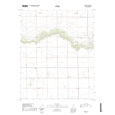
2023 Map of Jordan
USGS Topo · Published 2023About this map
Jordan sits at the intersection of a vast grid of rural routes in Quay County, where the high plains meet the dramatic breaks of the Llano Estacado. The landscape is defined by the sharp escarpments of Piñon Point and Ragland Hill, with several deep cuts such as Ish Canyon, Honey Canyon, and Rincon Canyon carving into the plateau. These geological features dominate the northern half of the quadrangle, while the southern portion transitions into open territory marked by ephemeral drainage like Bradley Creek.
Find a feature on this map
29 named features on this map. Tap any name to fly to it.
Don’t see what you’re looking for? This feature index may not catch every label — zoom into the map to look around manually.
Map Details
Editions of this 2023 Jordan Map
This is the sole edition of this map. No revisions or reprints were ever made.
Other maps of this area

1954 · Clovis
USGS Topo · 1:250,000

1958 · Clovis
USGS Topo · 1:250,000

1970 · Jordan
USGS Topo · 1:24,000

1970 · Quay
USGS Topo · 1:24,000
1970 · Circles S Mesa
USGS Topo · 1:24,000
1970 · Cunavea Basin
USGS Topo · 1:24,000

1971 · Ragland
USGS Topo · 1:24,000
1971 · Mesa Redonda
USGS Topo · 1:24,000

1973 · Weber City
USGS Topo · 1:24,000

1973 · House
USGS Topo · 1:24,000