
1955 Map of Jordan Valley
USGS Topo · Published 1963About this map
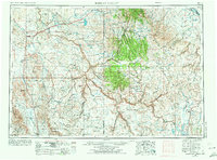
Jordan Valley serves as the primary hub for this high-desert region of eastern Oregon and western Idaho, where ranching and mining define the local economy. The landscape is dominated by the winding course of the Owyhee River and its dramatic Owyhee Canyon, which cuts through volcanic plateaus and buttes like Jackies Butte and Iron Mtn. Water management is central to the area's survival, evidenced by substantial works such as Antelope Reservoir and Little Grassy Reservoir.
Find a feature on this map
48 named features on this map. Tap any name to fly to it.
Don’t see what you’re looking for? This feature index may not catch every label — zoom into the map to look around manually.
Map Details
Editions of this 1955 Jordan Valley Map
3 editions found
Other maps of this area

1882 · Paradise
USGS Topo · 1:250,000

1886 · Disaster
USGS Topo · 1:250,000

1892 · Mountain Home
USGS Topo · 1:125,000

1892 · Bisuka
USGS Topo · 1:125,000

1892 · Silver City
USGS Topo · 1:125,000

1893 · Mountain Home
USGS Topo · 1:125,000

1893 · Paradise
USGS Topo · 1:250,000

1893 · Disaster
USGS Topo · 1:250,000

1894 · Bisuka
USGS Topo · 1:125,000

1894 · Silver City
USGS Topo · 1:125,000