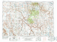
1955 Map of Jordan Valley
USGS Topo · Published 1978About this map
The Owyhee Mountains and the dramatic incisions of the Owyhee Canyon dominate this high-desert landscape in the mid-1950s. The settlement at Jordan Valley serves as a remote hub near the crossing of Jordan Creek, while smaller outposts like Basque and Rome dot the vast sagebrush and lava plains. This era shows the region's ranching and transit footprint before modern expansion, with livestock water management visible at Antelope Reservoir and Scotts Reservoir. The map captures the isolation of the Fort McDermitt Indian Reservation and Duck Valley Indian Reservation, situated along the border of Oregon and Idaho. Significant topographical features like Quicksilver Mountain and South Mountain define the skyline, while travelers relied on routes such as Blue Mountain Pass to navigate the complex volcanic terrain and deep river breaks of the Owyhee River.
Find a feature on this map
53 named features on this map. Tap any name to fly to it.
Don’t see what you’re looking for? This feature index may not catch every label — zoom into the map to look around manually.
Map Details
Editions of this 1955 Jordan Valley Map
3 editions found

Other maps of this area

1882 · Paradise
USGS Topo · 1:250,000

1886 · Disaster
USGS Topo · 1:250,000

1892 · Mountain Home
USGS Topo · 1:125,000

1892 · Bisuka
USGS Topo · 1:125,000

1892 · Silver City
USGS Topo · 1:125,000

1893 · Mountain Home
USGS Topo · 1:125,000

1893 · Paradise
USGS Topo · 1:250,000

1893 · Disaster
USGS Topo · 1:250,000

1894 · Bisuka
USGS Topo · 1:125,000

1894 · Silver City
USGS Topo · 1:125,000