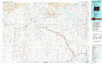
1994 Map of Jordan Valley
USGS Topo · Published 1994About this map
Owyhee Wild and Scenic River carves a deep path through this remote corner of southeastern Oregon and southwestern Idaho, revealing a landscape defined by volcanic activity and seasonal water. The northern reaches are dominated by the Saddle Butte Lava Field and the Owyhee Canyon, while the namesake Jordan Valley settlement serves as the primary hub along Highway 95. This 1994 map captures the infrastructure of the high desert, from the Antelope Reservoir that sustains local ranching to the isolated Rome State Airport near the community of Rome. Historically significant ranching outposts and small settlements like Arock and Danner are situated near vital water sources such as Jordan Creek and Crooked Creek, illustrating the long-standing human reliance on the region's scattered springs and drainages in an otherwise arid environment.
Find a feature on this map
63 named features on this map. Tap any name to fly to it.
Don’t see what you’re looking for? This feature index may not catch every label — zoom into the map to look around manually.
Map Details
Editions of this 1994 Jordan Valley Map
2 editions found
Other maps of this area

1892 · Silver City
USGS Topo · 1:125,000

1894 · Silver City
USGS Topo · 1:125,000

1898 · Silver City
USGS Topo · 1:125,000

1955 · Jordan Valley
USGS Topo · 1:250,000

1955 · Burns
USGS Topo · 1:250,000

1955 · Adel
USGS Topo · 1:250,000

1955 · Boise
USGS Topo · 1:250,000

1957 · Adel
USGS Topo · 1:250,000

1957 · Jordan Valley
USGS Topo · 1:250,000

1958 · Burns
USGS Topo · 1:250,000