
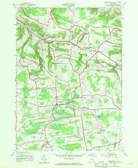
1943 Map of Jordanville
USGS Topo · Published 1954About this map
German Flats and the surrounding uplands of Warren and Stark are meticulously documented in this mid-century survey. The landscape is defined by its agricultural character and significant spiritual landmarks, most notably the Holy Trinity Monastery situated north of the village of Jordanville. This area of New York reflects a dense network of early settlement family ties, evidenced by numerous small burial grounds including Heath Cem, Paine Cem, and Pooler Cem scattered among the hills.
Find a feature on this map
43 named features on this map. Tap any name to fly to it.
Don’t see what you’re looking for? This feature index may not catch every label — zoom into the map to look around manually.
Map Details
Editions of this 1943 Jordanville Map
2 editions found
Other maps of this area

1898 · Utica
USGS Topo · 1:62,500

1900 · Little Falls
USGS Topo · 1:62,500

1900 · Utica
USGS Topo · 1:62,500

1903 · Richfield Springs
USGS Topo · 1:62,500

1903 · Little Falls
USGS Topo · 1:62,500

1907 · Winfield
USGS Topo · 1:62,500

1939 · Little Falls
USGS Topo · 1:62,500

1943 · Schuyler Lake
USGS Topo · 1:24,000

1943 · Richfield Springs
USGS Topo · 1:24,000
1943 · Herkimer
USGS Topo · 1:24,000