2024 Map of Joseph
USGS Topo · Published 2024About this map
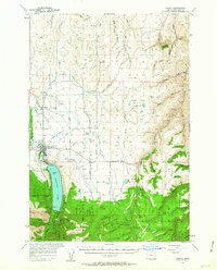
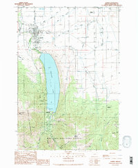
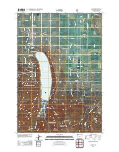
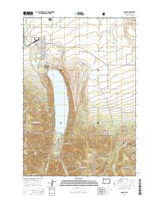
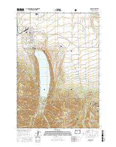
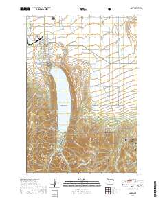
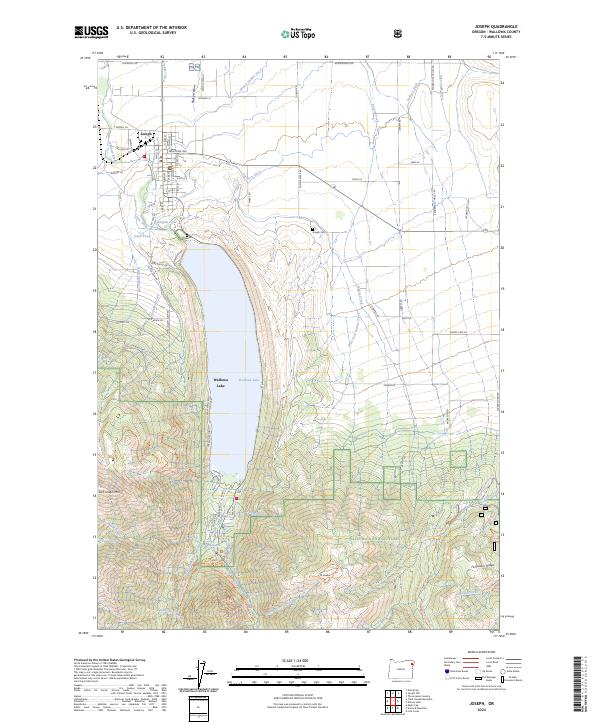
Joseph serves as the gateway to the high alpine terrain of northeastern Oregon, where the valley floor transitions into the protected peaks of the Eagle Cap Wilderness. The landscape is dominated by the striking glacial waters of Wallowa Lake, which is framed by the massive rises of Chief Joseph Mtn and Mt Howard. This modern survey illustrates the critical water infrastructure of the region, featuring an intricate network of irrigation channels such as Granger Ditch, Wrenn Dobbin Ditch, and Farmers Ditch that sustain the agricultural lands north of the lake. Within the Wallowa National Forest, the map traces the convergence of the East Fork Wallowa River and West Fork Wallowa River near the site of Wallowa Falls, highlighting the rugged hydraulic and topographic character of the Wallowa Mountains.
Find a feature on this map
126 named features on this map. Tap any name to fly to it.
Don’t see what you’re looking for? This feature index may not catch every label — zoom into the map to look around manually.
Map Details
Editions of this 2024 Joseph Map
This is the sole edition of this map. No revisions or reprints were ever made.
Historical Maps of Joseph Through Time
7 maps found