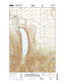
2014 Map of Joseph
USGS Topo · Published 2014About this map
The town of Joseph sits at the northern end of its namesake valley, serving as a gateway to the high alpine terrain of the Wallowa National Forest. This landscape is defined by the deep glacial waters of Wallowa Lake, which is hemmed in by steep mountain walls including Chief Joseph Mountain and Mt Howard. The cultural significance of the region is centered at the Nez Perce National Historic Park, where the Old Chief Joseph Gravesite overlooks the lake. To the north, the land transitions into a productive agricultural basin, intricately carved by a network of irrigation channels such as Granger Ditch, Farmers Ditch, and Wrenn Dobbin Ditch. Higher elevations to the south and east reveal complex hydrology, including Wallowa Falls and the headwaters of West Fork Wallowa Cr and McCully Cr, while the high Ferguson Ridge dominates the eastern horizon.
Find a feature on this map
76 named features on this map. Tap any name to fly to it.
Don’t see what you’re looking for? This feature index may not catch every label — zoom into the map to look around manually.
Map Details
Editions of this 2014 Joseph Map
This is the sole edition of this map. No revisions or reprints were ever made.
Other maps of this area

1954 · Cornucopia
USGS Topo · 1:62,500

1954 · Eagle Cap
USGS Topo · 1:62,500

1955 · Grangeville
USGS Topo · 1:250,000

1957 · Enterprise
USGS Topo · 1:62,500

1957 · Joseph
USGS Topo · 1:62,500

1959 · Grangeville
USGS Topo · 1:250,000

1986 · Enterprise
USGS Topo · 1:100,000

1990 · Chief Joseph Mtn
USGS Topo · 1:24,000
1990 · Eagle Cap
USGS Topo · 1:24,000
1990 · Joseph
USGS Topo · 1:24,000