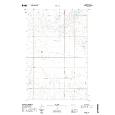
2020 Map of Josephine
USGS Topo · Published 2020About this map
Josephine sits at the center of this Benson County landscape, where the prairie is defined by the depressions of Stony Lake and Long Lake. The area reflects a sparse, agricultural settlement pattern typical of North Dakota, with a grid of section roads like 36th St NE and Co Rd 0328 connecting isolated farmsteads and rural landmarks. Local heritage is centered around the Stony Lake Lutheran Cem ELCA and the Antelope Valley Cem, which serve as physical anchors for the surrounding community history. The terrain is marked by Peterson Coulee, a significant drainage feature that cuts across the township boundaries. This 2020 update provides a clear view of the modern rural infrastructure and land management within the T152N and T151N townships.
Find a feature on this map
22 named features on this map. Tap any name to fly to it.
Don’t see what you’re looking for? This feature index may not catch every label — zoom into the map to look around manually.
Map Details
Editions of this 2020 Josephine Map
This is the sole edition of this map. No revisions or reprints were ever made.
Other maps of this area

1931 · Oberon
USGS Topo · 1:62,500

1932 · Flora
USGS Topo · 1:62,500

1932 · Grahams Island
USGS Topo · 1:62,500

1950 · Oberon SW
USGS Topo · 1:24,000

1950 · Grahams Island
USGS Topo · 1:62,500

1950 · Oberon
USGS Topo · 1:62,500

1951 · Oberon
USGS Topo · 1:24,000

1951 · Flora SE
USGS Topo · 1:24,000

1951 · Minnewaukan East
USGS Topo · 1:24,000

1951 · Black Hammer Hill
USGS Topo · 1:24,000