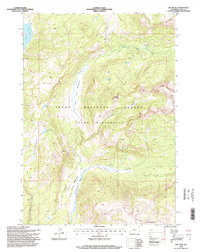
1996 Map of Joy Peak
USGS Topo · Published 1998About this map
Teton Wilderness and the Teton National Forest dominate this 1996 survey, which documents a high-altitude landscape defined by glacial lakes and the headwaters of the Buffalo Fork. The map centers on the sharp relief of Joy Peak and Soda Mountain, surrounded by a network of drainage systems including Clear Creek and the Soda Fork. This era of the late twentieth century reflects a landscape managed for conservation and wilderness preservation, where human presence is largely limited to a sparse network of mapped trails.
Find a feature on this map
18 named features on this map. Tap any name to fly to it.
Don’t see what you’re looking for? This feature index may not catch every label — zoom into the map to look around manually.
Map Details
Editions of this 1996 Joy Peak Map
This is the sole edition of this map. No revisions or reprints were ever made.
Other maps of this area

1885 · Lake
USGS Topo · 1:125,000

1895 · Lake
USGS Topo · 1:125,000

1896 · Lake
USGS Topo · 1:125,000

1901 · Lake
USGS Topo · 1:125,000

1902 · Mt Leidy
USGS Topo · 1:125,000

1906 · Lake
USGS Topo · 1:125,000

1911 · Lake
USGS Topo · 1:125,000

1955 · Ashton
USGS Topo · 1:250,000

1955 · Driggs
USGS Topo · 1:250,000

1958 · Driggs
USGS Topo · 1:250,000