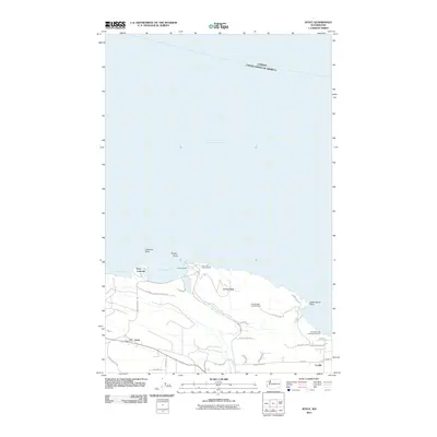
2011 Map of Joyce
USGS Topo · Published 2011About this map
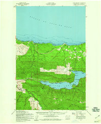
Port Crescent and the neighboring community of Joyce anchor this coastal survey along the Strait of Juan de Fuca. The landscape is defined by the intersection of the Olympic National Forest Rd and the jagged shoreline of the Olympic Peninsula. Marine navigation and recreation are central to the area's identity, evidenced by landmarks like Tongue Point, Crescent Bay, and the Freshwater Bay Boat Launch Ramp. Inland, the terrain rises sharply toward Striped Peak, where the Striped Peak Lookout Tower provides a vantage point over the saltwater. Local infrastructure is sparse but specific, with the Joyce Post Office serving the small settlement and the Salt Creek Campground offering public access to the Salt Creek drainage. The international boundary between Canada and the United States is clearly marked across the northern waters.
Find a feature on this map
36 named features on this map. Tap any name to fly to it.
Don’t see what you’re looking for? This feature index may not catch every label — zoom into the map to look around manually.
Map Details
Editions of this 2011 Joyce Map
This is the sole edition of this map. No revisions or reprints were ever made.
Other maps of this area

1918 · Lake Crescent
USGS Topo · 1:62,500

1919 · Port Crescent
USGS Topo · 1:62,500

1922 · Lake Crescent
USGS Topo · 1:62,500

1950 · Elwha
USGS Topo · 1:24,000

1950 · Lake Sutherland
USGS Topo · 1:24,000
1950 · Angeles Point
USGS Topo · 1:24,000
1950 · Joyce
USGS Topo · 1:24,000
1950 · Disque
USGS Topo · 1:24,000

1950 · Lake Crescent
USGS Topo · 1:24,000
1950 · Lake Crescent
USGS Topo · 1:62,500