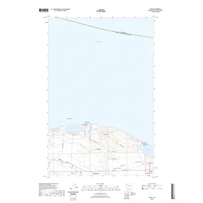
2020 Map of Joyce
USGS Topo · Published 2020About this map
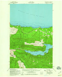
Joyce stands as a focal point along the northern coast of the Olympic Peninsula, where the landscape meets the Salish Sea. This 2020 topographic record details the transition from the marine environments of Crescent Bay and Agate Bay to the rising elevations of Striped Peak and Huckleberry Hill. The map highlights the maritime-influenced geography of Clallam County, including the prominent Tongue Point and the international boundary marking the Canada United States of America border in the offshore waters. Inland, a network of rural roads such as Piedmont Rd and Camp Hayden Rd connects the small settlements of Joyce and Coville. The drainage patterns are defined by the winding course of Salt Cr, which empties into the sea near the base of the highlands, providing a clear picture of the region's contemporary rural and coastal infrastructure.
Find a feature on this map
38 named features on this map. Tap any name to fly to it.
Don’t see what you’re looking for? This feature index may not catch every label — zoom into the map to look around manually.
Map Details
Editions of this 2020 Joyce Map
This is the sole edition of this map. No revisions or reprints were ever made.
Other maps of this area

1918 · Lake Crescent
USGS Topo · 1:62,500

1919 · Port Crescent
USGS Topo · 1:62,500

1922 · Lake Crescent
USGS Topo · 1:62,500

1950 · Elwha
USGS Topo · 1:24,000

1950 · Lake Sutherland
USGS Topo · 1:24,000
1950 · Angeles Point
USGS Topo · 1:24,000
1950 · Joyce
USGS Topo · 1:24,000
1950 · Disque
USGS Topo · 1:24,000

1950 · Lake Crescent
USGS Topo · 1:24,000
1950 · Lake Crescent
USGS Topo · 1:62,500