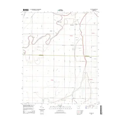
2014 Map of Joyland
USGS Topo · Published 2014About this map
Saint Francis River winds through this alluvial landscape, marking the transition between the agricultural reaches of Poinsett and Crittenden counties. The map documents a rural network of farm-to-market roads and small settlements like Joyland, Mount Olive, and Galilee. Historically significant for its water management and drainage, the area shows the Tyronza River Cutoff and Mack Bayou, illustrating the complex hydrology of the Arkansas Delta. These water features, alongside landmarks like Yellow Banks and Cummins Bar, reveal a terrain shaped by the river's movement over time. Genealogists and local historians will find several burial sites noted, including Mt Olive Cem, King Solomon Cem, and E Tyronza Cem, which serve as quiet markers of the families who settled this fertile river bottom land during the late 20th and early 21st centuries.
Find a feature on this map
82 named features on this map. Tap any name to fly to it.
Don’t see what you’re looking for? This feature index may not catch every label — zoom into the map to look around manually.
Map Details
Editions of this 2014 Joyland Map
This is the sole edition of this map. No revisions or reprints were ever made.
Other maps of this area

1940 · Deckerville
USGS Topo · 1:62,500

1940 · Princedale
USGS Topo · 1:62,500

1940 · Dee
USGS Topo · 1:62,500

1941 · Marked Tree
USGS Topo · 1:62,500

1953 · Memphis
USGS Topo · 1:250,000

1956 · Marked Tree
USGS Topo · 1:62,500

1956 · Memphis
USGS Topo · 1:250,000

1956 · Princedale
USGS Topo · 1:62,500

1957 · Deckerville
USGS Topo · 1:62,500

1958 · Dee
USGS Topo · 1:62,500