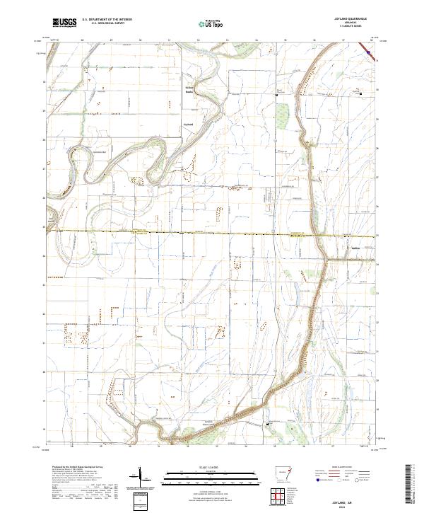
2024 Map of Joyland
USGS Topo · Published 2024About this map
The Saint Francis River and Tyronza River wind through this eastern Arkansas landscape, where the boundary between Poinsett Co and Crittenden Co cuts through agricultural fields. Modern drainage and flood control are evident in the Tyronza River Cutoff and the course of Mack Bayou, which shape the local topography. Small settlements like Joyland and Yellow Banks sit near the river bends, reflecting the area's historical reliance on these waterways for transport and irrigation.
Find a feature on this map
79 named features on this map. Tap any name to fly to it.
Don’t see what you’re looking for? This feature index may not catch every label — zoom into the map to look around manually.
Map Details
Editions of this 2024 Joyland Map
This is the sole edition of this map. No revisions or reprints were ever made.
Other maps of this area

1940 · Deckerville
USGS Topo · 1:62,500

1940 · Princedale
USGS Topo · 1:62,500

1940 · Dee
USGS Topo · 1:62,500

1941 · Marked Tree
USGS Topo · 1:62,500

1953 · Memphis
USGS Topo · 1:250,000

1956 · Marked Tree
USGS Topo · 1:62,500

1956 · Memphis
USGS Topo · 1:250,000

1956 · Princedale
USGS Topo · 1:62,500

1957 · Deckerville
USGS Topo · 1:62,500

1958 · Dee
USGS Topo · 1:62,500