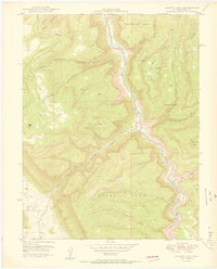
1950 Map of Juanita Arch
USGS Topo · Published 1950About this map
The Dolores River carves through the high desert of Mesa County in this 1950 publication, which reflects a landscape defined by both its natural geology and early Cold War mineral exploration. The United States Atomic Energy Commission co-published this survey, highlighting the era's focus on the region's uranium and vanadium potential. Features like the Depression Mines and Maverick Mines on Flat Top Mesa, along with the Copper Rivet Mine near Salt Creek, mark the industrial footprint on the land.
Find a feature on this map
22 named features on this map. Tap any name to fly to it.
Don’t see what you’re looking for? This feature index may not catch every label — zoom into the map to look around manually.
Map Details
Editions of this 1950 Juanita Arch Map
3 editions found
Other maps of this area

1885 · La Sal
USGS Topo · 1:250,000

1916 · Paradox Valley
USGS Topo · 1:125,000

1922 · Paradox Valley
USGS Topo · 1:125,000

1948 · Roc Creek
USGS Topo · 1:24,000

1949 · Roc Creek
USGS Topo · 1:24,000

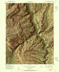
1949 · Juanita Arch
USGS Topo · 1:24,000

1949 · Red Canyon
USGS Topo · 1:24,000

1949 · Calamity Mesa
USGS Topo · 1:24,000

1949 · Gateway
USGS Topo · 1:24,000

1950 · Juanita Arch
USGS Topo · 1:24,000