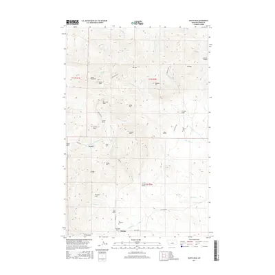
2017 Map of Judith Peak
USGS Topo · Published 2017About this map
Maiden and Giltedge anchor this high-elevation study of the Judith Mountains, where the landscape is defined by a dense concentration of peaks and steep drainage gulches. The terrain is dominated by prominent summits such as Judith Peak, Maginnis Mtn, and Sheep Mtn, with narrow corridors like Maiden Canyon and Chicago Gulch providing the primary pathways through the interior. Local history is evidenced by the Fort Maginnis Cem and Gilt Edge Cem, reflecting the early settlement of this mining and ranching district. Waterways including Armells Cr and Fords Cr flow from the central highlands, tracing the rugged topography of the Fergus County interior. The road network, including Maiden Rd and Gilt Edge Rd, connects these isolated mountain outposts to the surrounding plains.
Find a feature on this map
45 named features on this map. Tap any name to fly to it.
Don’t see what you’re looking for? This feature index may not catch every label — zoom into the map to look around manually.
Map Details
Editions of this 2017 Judith Peak Map
This is the sole edition of this map. No revisions or reprints were ever made.
Other maps of this area

1941 · Lewistown
USGS Topo · 1:62,500

1941 · Judith Peak
USGS Topo · 1:62,500

1944 · Lewistown
USGS Topo · 1:62,500

1944 · Judith Peak
USGS Topo · 1:62,500

1954 · Lewistown
USGS Topo · 1:250,000

1959 · Lewistown
USGS Topo · 1:250,000

1978 · Lewistown
USGS Topo · 1:100,000

1985 · Fergus
USGS Topo · 1:24,000

1985 · Hilger
USGS Topo · 1:24,000

1985 · Armells
USGS Topo · 1:24,000