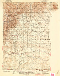
1944 Map of Judith Peak
USGS Topo · Published 1944About this map
The Ruins of Fort Maginnis and its associated Fort Maginnis Cem anchor the historic center of this 1941 topography. Located in the shadow of the mountains, the area shows a landscape transitioning from high-altitude mining to lowland ranching. A legacy of heavy industry is visible in numerous dormant workings such as the Spotted Horse Mine (Inactive) and Giltedge Mine (Inactive), which are clustered near Judith Peak and Maginnis Mtn.
Find a feature on this map
54 named features on this map. Tap any name to fly to it.
Don’t see what you’re looking for? This feature index may not catch every label — zoom into the map to look around manually.
Map Details
Editions of this 1944 Judith Peak Map
2 editions found
Other maps of this area

1889 · Big Snowy Mountain
USGS Topo · 1:250,000

1893 · Big Snowy Mountain
USGS Topo · 1:250,000

1941 · Lewistown
USGS Topo · 1:62,500

1941 · Judith Peak
USGS Topo · 1:62,500

1944 · Lewistown
USGS Topo · 1:62,500

1944 · Judith Peak
USGS Topo · 1:62,500

1954 · Roundup
USGS Topo · 1:250,000

1954 · Lewistown
USGS Topo · 1:250,000

1958 · Roundup
USGS Topo · 1:250,000

1959 · Lewistown
USGS Topo · 1:250,000