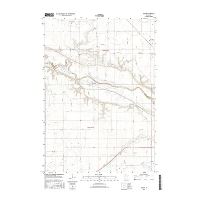
2016 Map of Judson
USGS Topo · Published 2016About this map
The Minnesota River winds across this portion of Blue Earth and Nicollet Counties, defining the physical and historical character of Judson. This township-dominated landscape is heavily marked by its pioneer-era roots, evidenced by a high density of small family and community burial grounds including Trinity Cem, Zion Cem, Williams Cem, Hebron Cem, and Jerusalem Cem. These sites, often situated on high ground overlooking the river valley or near established section lines, provide essential touchstones for local genealogical research.
Find a feature on this map
49 named features on this map. Tap any name to fly to it.
Don’t see what you’re looking for? This feature index may not catch every label — zoom into the map to look around manually.
Map Details
Editions of this 2016 Judson Map
This is the sole edition of this map. No revisions or reprints were ever made.
Other maps of this area

1951 · Mankato West
USGS Topo · 1:62,500

1953 · New Ulm
USGS Topo · 1:250,000

1957 · New Ulm
USGS Topo · 1:250,000

1958 · New Ulm
USGS Topo · 1:250,000

1964 · Courtland
USGS Topo · 1:24,000

1965 · North Star
USGS Topo · 1:24,000

1965 · Perth
USGS Topo · 1:24,000

1965 · Cambria
USGS Topo · 1:24,000
1965 · Nicollet
USGS Topo · 1:24,000

1967 · New Ulm
USGS Topo · 1:250,000