1965 Map of Perth
USGS Topo · Published 1966About this map
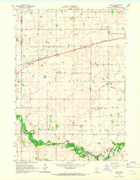
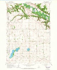
The Watonwan River winds across the southern reaches of this mid-century landscape, carving a distinct green belt through the agrarian townships of Ceresco, Lincoln, and Madelia. This 1965-era survey illustrates an intensive hydraulic transformation of the upper Midwest prairie, where the natural drainage of Butternut Valley is heavily supplemented by an engineered network including Judicial Ditch No 7, Judicial Ditch No 48, and County Ditch No 50.
Find a feature on this map
22 named features on this map. Tap any name to fly to it.
Don’t see what you’re looking for? This feature index may not catch every label — zoom into the map to look around manually.
Map Details
Editions of this 1965 Perth Map
This is the sole edition of this map. No revisions or reprints were ever made.
Other maps of this area
1951 · Mankato West
USGS Topo · 1:62,500

1953 · New Ulm
USGS Topo · 1:250,000

1954 · Fairmont
USGS Topo · 1:250,000

1957 · New Ulm
USGS Topo · 1:250,000

1958 · New Ulm
USGS Topo · 1:250,000

1958 · Fairmont
USGS Topo · 1:250,000
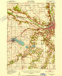
1965 · Madelia
USGS Topo · 1:24,000
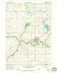
1965 · Hanska
USGS Topo · 1:24,000
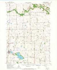
1965 · Cambria
USGS Topo · 1:24,000

1967 · New Ulm
USGS Topo · 1:250,000