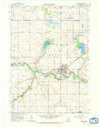
1965 Map of Madelia
USGS Topo · Published 1966About this map
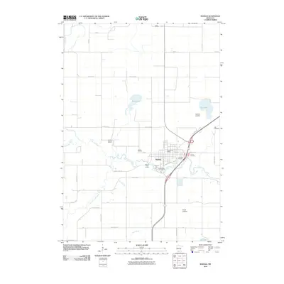
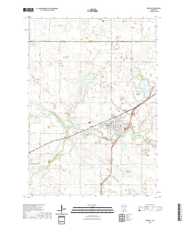
Madelia serves as the central hub of this mid-1960s Watonwan County landscape, situated at a bend in the Watonwan River where the Chicago and North Western railroad intersects the town's grid. The settlement is well-established with civic features including a High School, Watona Park, and local burial grounds like Madelia Cemetery and Calvary Cemetery. Beyond the town limits, the geography is defined by a series of shallow basins and lakebeds, such as Hopkins Lakebed and Goose Lakebed, suggesting a terrain heavily modified by drainage for agriculture. Conservation efforts are evident in the numerous protected areas, including the Wilson State Wildlife Management Area and Bergdahl State Wildlife Management Area. The map also documents the importance of local water management through features like Judicial Ditch No 6 and the Riverside Dam.
Find a feature on this map
35 named features on this map. Tap any name to fly to it.
Don’t see what you’re looking for? This feature index may not catch every label — zoom into the map to look around manually.
Map Details
Editions of this 1965 Madelia Map
This is the sole edition of this map. No revisions or reprints were ever made.
Historical Maps of Madelia Through Time
6 maps found