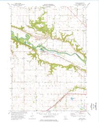
1974 Map of Judson
USGS Topo · Published 1976About this map
The Minnesota River cuts a wide valley through this mid-1970s landscape, serving as the boundary between Nicollet and Judson townships. The settlement of Judson and the nearby rail stop at Cray are positioned along the Chicago and North Western railroad, which follows the river's southern bluffs. This era shows a rural landscape defined by water management and industry, evidenced by the drainage networks of Ditch No 11 and Ditch No 12 to the north, and several Gravel Pits and Tailings Ponds near the riverbanks.
Find a feature on this map
27 named features on this map. Tap any name to fly to it.
Don’t see what you’re looking for? This feature index may not catch every label — zoom into the map to look around manually.
Map Details
Editions of this 1974 Judson Map
This is the sole edition of this map. No revisions or reprints were ever made.
Other maps of this area

1951 · Mankato West
USGS Topo · 1:62,500

1953 · New Ulm
USGS Topo · 1:250,000

1957 · New Ulm
USGS Topo · 1:250,000

1958 · New Ulm
USGS Topo · 1:250,000

1964 · Courtland
USGS Topo · 1:24,000

1965 · North Star
USGS Topo · 1:24,000

1965 · Perth
USGS Topo · 1:24,000

1965 · Cambria
USGS Topo · 1:24,000
1965 · Nicollet
USGS Topo · 1:24,000

1967 · New Ulm
USGS Topo · 1:250,000