
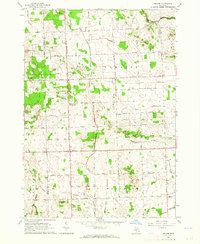
1963 Map of Juhl
USGS Topo · Published 1964About this map
The agricultural lands of Marlette, Elmer, and Flynn townships are defined by a complex network of drainage ditches and small settlements in this early 1960s survey. The landscape is dominated by local infrastructure, featuring social and religious hubs like the Red Star Community Building, Flynn Ch, and Elk Ch. Small communities such as Juhl and Hale are visible, alongside specialized landmarks like the Drive-in Theater near the eastern border and several Landing Fields.
Find a feature on this map
67 named features on this map. Tap any name to fly to it.
Don’t see what you’re looking for? This feature index may not catch every label — zoom into the map to look around manually.
Map Details
Editions of this 1963 Juhl Map
This is the sole edition of this map. No revisions or reprints were ever made.
Other maps of this area

1954 · Flint
USGS Topo · 1:250,000

1958 · Flint
USGS Topo · 1:250,000

1961 · Brown City
USGS Topo · 1:24,000

1961 · Yale
USGS Topo · 1:24,000

1963 · Snover
USGS Topo · 1:24,000

1963 · Sandusky
USGS Topo · 1:24,000

1963 · Peck
USGS Topo · 1:24,000

1963 · Marlette
USGS Topo · 1:24,000

1963 · Burnside
USGS Topo · 1:24,000
1963 · Decker
USGS Topo · 1:24,000