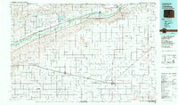
1983 Map of Julesburg
USGS Topo · Published 1983About this map
The South Platte River corridor dominates this northeastern Colorado landscape, serving as the primary artery for settlement and infrastructure. Along its banks, the Union Pacific railroad connects established agricultural hubs like Julesburg, Ovid, and Sedgwick. The map illustrates a complex irrigation network essential for High Plains farming, featuring the Peterson Canal, Settlers Ditch, and the significant Julesburg Reservoir. To the south, the Burlington Northern line supports a second string of prairie towns including Haxtun, Paoli, and Holyoke.
Find a feature on this map
64 named features on this map. Tap any name to fly to it.
Don’t see what you’re looking for? This feature index may not catch every label — zoom into the map to look around manually.
Map Details
Editions of this 1983 Julesburg Map
This is the sole edition of this map. No revisions or reprints were ever made.
Other maps of this area

1897 · Ogallala
USGS Topo · 1:125,000

1899 · Sidney
USGS Topo · 1:125,000

1900 · Chappell
USGS Topo · 1:125,000

1900 · Ogallala
USGS Topo · 1:125,000

1951 · Reiradon Hill
USGS Topo · 1:24,000

1951 · Galien
USGS Topo · 1:24,000

1951 · Iliff
USGS Topo · 1:24,000

1952 · Julesburg SW
USGS Topo · 1:24,000

1952 · Julesburg SE
USGS Topo · 1:24,000

1952 · Marks Butte
USGS Topo · 1:24,000