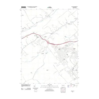
2010 Map of Julian
USGS Topo · Published 2010About this map
Bald Eagle Creek cuts a defining path through this landscape, marking the transition between the valley floor and the heights of Skytop Mountain Rd. This 2010 survey shows the residential growth spreading from State College into communities like Park Forest Village and Park Hills. Aviation history is visible across the quadrangle, with the Dillen Airport, Nittany Valley Aerodrome, and the State College Air Depot all documented. For those tracing local families, the map anchors several burial grounds, including the Henderson Cemetery and Grays Cemetery. To the south, the terrain shifts into the uniquely named The Barrens and along Gatesburg Ridge, offering a clear view of the undeveloped land still present just miles from the expanding suburbs of Marysville and Krumrine.
Find a feature on this map
72 named features on this map. Tap any name to fly to it.
Don’t see what you’re looking for? This feature index may not catch every label — zoom into the map to look around manually.
Map Details
Editions of this 2010 Julian Map
This is the sole edition of this map. No revisions or reprints were ever made.
Other maps of this area

1908 · Bellefonte
USGS Topo · 1:62,500

1909 · Bellefonte
USGS Topo · 1:62,500

1919 · Menno
USGS Topo · 1:62,500

1922 · Philipsburg
USGS Topo · 1:62,500

1923 · Tyrone
USGS Topo · 1:62,500

1929 · Tyrone
USGS Topo · 1:48,000

1933 · Tyrone
USGS Topo · 1:62,500

1935 · Allensville
USGS Topo · 1:62,500

1938 · Allensville
USGS Topo · 1:62,500

1939 · Philipsburg
USGS Topo · 1:62,500