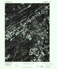
1977 Map of Julian
USGS Topo · Published 1979About this map
Bald Eagle Mountain dominates the central landscape of this 1970s orthophotograph, creating a sharp natural divide between the valley floor and the expanding human footprint. To the northwest, the community of Julian sits near the winding course of Bald Eagle Creek, where small-scale agricultural fields follow the water's path. In contrast, the southeastern portion of the map reveals the concentrated development of State College, characterized by dense street grids and burgeoning residential subdivisions. Produced in cooperation with the Soil Conservation Service, this imagery captures the distinct land-use patterns of Centre County, from the linear ridge-top forests to the intricate quilt of farmland and the suburban growth pushing outward from the university town center.
Find a feature on this map
4 named features on this map. Tap any name to fly to it.
Don’t see what you’re looking for? This feature index may not catch every label — zoom into the map to look around manually.
Map Details
Editions of this 1977 Julian Map
This is the sole edition of this map. No revisions or reprints were ever made.
Other maps of this area

1908 · Bellefonte
USGS Topo · 1:62,500

1909 · Bellefonte
USGS Topo · 1:62,500

1919 · Menno
USGS Topo · 1:62,500

1922 · Philipsburg
USGS Topo · 1:62,500

1923 · Tyrone
USGS Topo · 1:62,500

1929 · Tyrone
USGS Topo · 1:48,000

1933 · Tyrone
USGS Topo · 1:62,500

1935 · Allensville
USGS Topo · 1:62,500

1938 · Allensville
USGS Topo · 1:62,500

1939 · Philipsburg
USGS Topo · 1:62,500