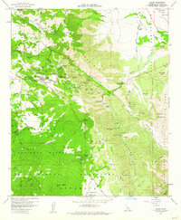
1960 Map of Julian
USGS Topo · Published 1962About this map
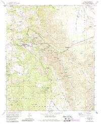
The gold-mining heritage of the Peninsular Ranges is on display here, centered on the historic townsite of Julian. This 1960 field-checked survey reveals an intensive network of claims and workings along the eastern slopes of Volcan Mountain and the deep cut of Banner Canyon. Dozens of named mines, including the Chariot Mine, Golden Chariot Mine, and the San Diego Mine Group, trace the complex mineral veins of the Julian Mining District. To the east, the terrain drops into the San Felipe Valley, bordering the Anza-Borrego Desert. The map documents early 1960s local infrastructure, from the Julian High School and Julian Cemetery to seasonal mountain retreats like Kentwood-In-The-Pines and Whispering Pines. Water management in this high-elevation landscape is marked by the Cuyamaca Reservoir and numerous springs that once supported the busy extraction economy of the region.
Find a feature on this map
92 named features on this map. Tap any name to fly to it.
Don’t see what you’re looking for? This feature index may not catch every label — zoom into the map to look around manually.
Map Details
Editions of this 1960 Julian Map
5 editions found
Other maps of this area

1903 · Cuyamaca
USGS Topo · 1:125,000

1903 · Ramona
USGS Topo · 1:125,000

1904 · Southern California Sheet No. 2
USGS Topo · 1:250,000

1931 · Vallecito
USGS Topo · 1:125,000

1931 · Carrizo
USGS Topo · 1:125,000

1939 · Santa Ysabel
USGS Topo · 1:62,500

1939 · Borrego
USGS Topo · 1:62,500

1942 · Borego
USGS Topo · 1:62,500

1942 · Cuyapaipe
USGS Topo · 1:62,500

1942 · Cuyamaca Peak
USGS Topo · 1:62,500