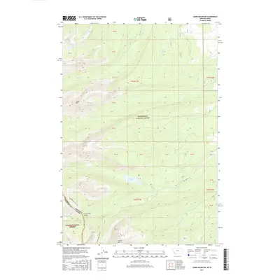
2017 Map of Jumbo Mountain
USGS Topo · Published 2017About this map
The Continental Divide defines the southwestern boundary of this high-altitude landscape, where the borders of Beaverhead National Forest and Salmon National Forest meet at the Montana-Idaho line. The terrain is characterized by prominent peaks including Jumbo Mtn in the west and Hirschy Mtn to the south, with drainage basins feeding numerous alpine creeks. Water is a central feature of the topography, from the centrally located Twin Lakes to the small Ovis Lake tucked into the northern slopes. A network of Forest Service routes, such as Twin Lakes Rd and roads like 183, provides access to these remote reaches. The map documents a classic wilderness interface where Little Moosehorn Cr, Rock Cr, and Big Lake Cr carve through the high country, illustrating the complex hydrology of the Bitterroot Range before these waters descend toward the larger valley systems.
Find a feature on this map
44 named features on this map. Tap any name to fly to it.
Don’t see what you’re looking for? This feature index may not catch every label — zoom into the map to look around manually.
Map Details
Editions of this 2017 Jumbo Mountain Map
This is the sole edition of this map. No revisions or reprints were ever made.
Other maps of this area

1955 · Dillon
USGS Topo · 1:250,000

1957 · Dillon
USGS Topo · 1:250,000

1958 · Dillon
USGS Topo · 1:250,000

1962 · Dillon
USGS Topo · 1:250,000

1965 · Dillon
USGS Topo · 1:250,000

1966 · Badger Spring Gulch
USGS Topo · 1:24,000

1966 · Shewag Lake
USGS Topo · 1:24,000

1966 · Miner Lake
USGS Topo · 1:24,000

1966 · Jumbo Mountain
USGS Topo · 1:24,000

1966 · Big Hole Pass
USGS Topo · 1:24,000