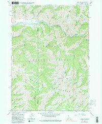
1964 Map of Jumbo Mtn
USGS Topo · Published 1983About this map
The South Fork Boise River winds through this high-elevation landscape on the border of Elmore and Camas Counties, where the Soldier Mountains meet the Sawtooth National Forest. This 1964 field-checked survey highlights a remote wilderness defined by a network of drainage systems like Iron Creek and Beaver Creek, and punctuated by landmark peaks such as Jumbo Mtn and the Iron Mtn Lookout. The river corridor provides the primary hub of human activity, featuring a string of riverside recreation sites including Baumgartner Campground, Bighorn Campground, and a Hot Spring near the mouth of Jumbo Creek. Inland, the terrain is traversable only by a series of high-mountain routes, labeled as Pack Trail and Jeep Trail, which connect isolated features like the Gardner Gulch Corral and the small alpine Heart Lake. Further south, the map identifies the Deer Park area and the point labeled Bremmer near Stewart Creek.
Find a feature on this map
43 named features on this map. Tap any name to fly to it.
Don’t see what you’re looking for? This feature index may not catch every label — zoom into the map to look around manually.
Map Details
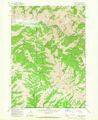
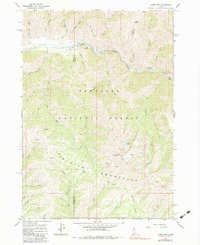
Editions of this 1964 Jumbo Mtn Map
3 editions found
Other maps of this area

1892 · Camas Prairie
USGS Topo · 1:125,000

1893 · Camas Prairie
USGS Topo · 1:125,000

1894 · Rocky Bar
USGS Topo · 1:125,000

1900 · Sawtooth
USGS Topo · 1:125,000

1955 · Hailey
USGS Topo · 1:250,000

1957 · Fairfield
USGS Topo · 1:62,500

1959 · Hailey
USGS Topo · 1:250,000

1962 · Hailey
USGS Topo · 1:250,000

1963 · Deer Mountain
USGS Topo · 1:24,000
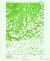
1963 · Sprout Mtn
USGS Topo · 1:24,000