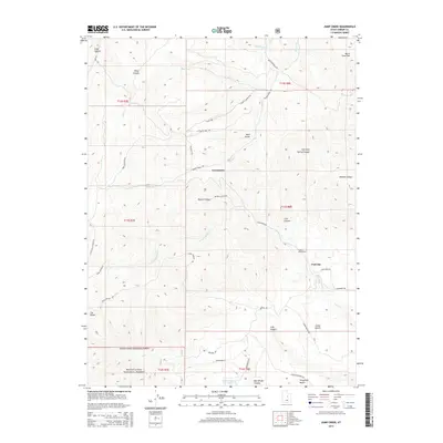
2014 Map of Jump Creek
USGS Topo · Published 2014About this map
Coal City and Consumers sit at the heart of this landscape, marking the legacy of Carbon County's resource-driven development. The terrain is defined by a dense network of canyons and draws, including Bryner Canyon, Wildcat Canyon, and Coal Canyon, which drain into the N Fork Gordon Cr and Beaver Cr. In the southern reaches, the boundary of the Manti-La Sal National Forest meets localized landmarks like The Elbow and the broad expanses of Cedar Bench and Telephone Bench. This area's utility and habitation are evidenced by numerous access routes such as Castle Valley Ridge Rd and Consumers Rd, alongside rural outposts like Cedar Mesa Ranch and Omans Ranch. The presence of Summerhouse Spring and the intricate naming of nearly every draw and fork suggest a deep, fine-grained familiarity with the land by those who worked these canyon walls.
Find a feature on this map
47 named features on this map. Tap any name to fly to it.
Don’t see what you’re looking for? This feature index may not catch every label — zoom into the map to look around manually.
Map Details
Editions of this 2014 Jump Creek Map
This is the sole edition of this map. No revisions or reprints were ever made.
Other maps of this area

1885 · Manti
USGS Topo · 1:250,000

1886 · Price River
USGS Topo · 1:250,000

1895 · Manti
USGS Topo · 1:250,000

1896 · Price River
USGS Topo · 1:250,000

1914 · Castle Gate
USGS Topo · 1:62,500

1916 · Castle Gate
USGS Topo · 1:62,500

1923 · Scofield
USGS Topo · 1:62,500

1925 · Scofield
USGS Topo · 1:62,500

1939 · Soldier Summit
USGS Topo · 1:62,500

1942 · Soldier Summit
USGS Topo · 1:62,500