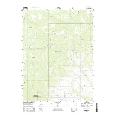
2017 Map of Jump Creek
USGS Topo · Published 2017About this map
Manti-LaSal National Forest anchors this high-elevation landscape, where the deeply incised drainages of Johnston Cr and Jump Cr carve through the plateau. The terrain is defined by dramatic topographic breaks such as Pete's Top and The Elbow, revealing the complex geological structures that historically supported carbon-rich industries. A network of primitive and improved routes like Jump Creek Rd and Consumers Rd suggests a landscape of active utility, connecting remote points like Summerhouse Spring and Cedar Bench to the broader region. Historical land use is evident in the naming of features such as Coal Canyon and Bryner Canyon, which reflect the area's legacy of resource extraction and local homesteading. The southern reaches are marked by the Telephone Bench and Bob Wright Canyon, showing the extent of early communication and transportation corridors through these canyonlands.
Find a feature on this map
45 named features on this map. Tap any name to fly to it.
Don’t see what you’re looking for? This feature index may not catch every label — zoom into the map to look around manually.
Map Details
Editions of this 2017 Jump Creek Map
This is the sole edition of this map. No revisions or reprints were ever made.
Other maps of this area

1885 · Manti
USGS Topo · 1:250,000

1886 · Price River
USGS Topo · 1:250,000

1895 · Manti
USGS Topo · 1:250,000

1896 · Price River
USGS Topo · 1:250,000

1914 · Castle Gate
USGS Topo · 1:62,500

1916 · Castle Gate
USGS Topo · 1:62,500

1923 · Scofield
USGS Topo · 1:62,500

1925 · Scofield
USGS Topo · 1:62,500

1939 · Soldier Summit
USGS Topo · 1:62,500

1942 · Soldier Summit
USGS Topo · 1:62,500