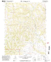
2001 Map of Jump Creek
USGS Topo · Published 2004About this map
Industrial activity and high-elevation terrain meet in the Manti-La Sal National Forest on this survey of the Price Ranger District. The landscape is defined by the canyon and bench systems common to Carbon County, specifically the prominent Telephone Bench and Cedar Bench overlooking the deeper drainages. Resource extraction is a primary feature of the era, with the Gordon Creek Mine and Swisher Mine located amidst the complex topography of Bryner Canyon and the North Fork Gordon Canyon.
Find a feature on this map
28 named features on this map. Tap any name to fly to it.
Don’t see what you’re looking for? This feature index may not catch every label — zoom into the map to look around manually.
Map Details
Editions of this 2001 Jump Creek Map
This is the sole edition of this map. No revisions or reprints were ever made.
Other maps of this area

1885 · Manti
USGS Topo · 1:250,000

1886 · Price River
USGS Topo · 1:250,000

1895 · Manti
USGS Topo · 1:250,000

1896 · Price River
USGS Topo · 1:250,000

1914 · Castle Gate
USGS Topo · 1:62,500

1916 · Castle Gate
USGS Topo · 1:62,500

1923 · Scofield
USGS Topo · 1:62,500

1925 · Scofield
USGS Topo · 1:62,500

1939 · Soldier Summit
USGS Topo · 1:62,500

1942 · Soldier Summit
USGS Topo · 1:62,500