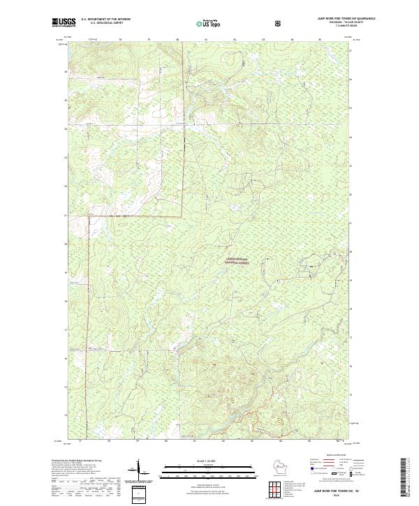
2022 Map of Jump River Fire Tower SW
USGS Topo · Published 2022About this map
Chequamegon National Forest dominates this section of Taylor County, characterized by a complex network of wetlands and drainage basins. The Jump River cuts through the northwest corner, while the Yellow River meanders across the southern reach, accompanied by dedicated paths like the Yellow River Hwy Trl. This area is defined by its water systems, from the expansive Kidrick Swamp to smaller tributaries such as Wolf Cr and Levitt Cr.
Find a feature on this map
25 named features on this map. Tap any name to fly to it.
Don’t see what you’re looking for? This feature index may not catch every label — zoom into the map to look around manually.
Map Details
Editions of this 2022 Jump River Fire Tower SW Map
This is the sole edition of this map. No revisions or reprints were ever made.
Other maps of this area

1945 · Black River
USGS Topo · 1:48,000

1947 · Sheldon
USGS Topo · 1:48,000

1949 · Sheldon
USGS Topo · 1:48,000

1949 · Jump River Fire Tower
USGS Topo · 1:48,000

1951 · Lublin
USGS Topo · 1:48,000

1951 · Gilman
USGS Topo · 1:62,500

1953 · Rice Lake
USGS Topo · 1:250,000

1959 · Rice Lake
USGS Topo · 1:250,000

1969 · Perkinstown
USGS Topo · 1:24,000
1969 · Lublin NW
USGS Topo · 1:24,000