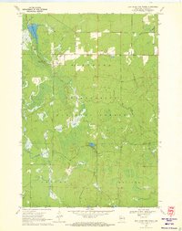
1970 Map of Jump River Fire Tower
USGS Topo · Published 1972About this map
Chequamegon National Forest dominates this northern Wisconsin landscape, where the Jump River Fire Tower stands as a sentinel over the township borders of Westboro, Grover, and Molitor. The terrain is defined by a complex network of wetlands and water bodies, including the significant Upper Silver Creek Flowage and the slow-moving Yellow River. Depth curves for these waters, compiled by the Wisconsin Department of Natural Resources, provide technical detail for the forest's interior lakes like Lost Lake and Pickerel Lake. Scattered Gravel Pits indicate localized extraction activity amidst the dense woodland and the sprawling Kiddie Swamp. This 1970 field-checked survey reveals a quiet, resource-oriented wilderness shaped by the drainage of Silver Creek and the North Fork and South Fork tributaries.
Find a feature on this map
19 named features on this map. Tap any name to fly to it.
Don’t see what you’re looking for? This feature index may not catch every label — zoom into the map to look around manually.
Map Details
Editions of this 1970 Jump River Fire Tower Map
This is the sole edition of this map. No revisions or reprints were ever made.
Other maps of this area

1944 · Ogema
USGS Topo · 1:48,000

1945 · Black River
USGS Topo · 1:48,000

1947 · Ogema
USGS Topo · 1:48,000

1949 · Ogema
USGS Topo · 1:48,000

1949 · Jump River Fire Tower
USGS Topo · 1:48,000

1951 · Lublin
USGS Topo · 1:48,000

1951 · Medford
USGS Topo · 1:48,000

1953 · Rice Lake
USGS Topo · 1:250,000

1959 · Rice Lake
USGS Topo · 1:250,000

1969 · Perkinstown
USGS Topo · 1:24,000